Mon-fri: 9:00-19:00
Deutsch
German
Registrieren
Login
Dateien
Stock
Foto
Video
Audio
Vektor
Offer
Collections
Packages
Lightbox
Posten
Häufigste Downloads
Beste
Populärste
Neu
Kostenlos
Drucke und Produkte
Canvas Prints
Framed Prints
Prints and Posters
Metal Prints
Acrylic Prints
iPhone Cases
Galaxy Cases
Pillows
Duvet Covers
Shower Curtain
T-Shirts
Greeting Cards
Tote Bags
Kategorien
Portrait
Tiere
Video
Seiten Infos
Über uns
Support
Datenschutzerklärung
FAQ
Kontakt
Ihr Warenkorb ist leer.
Dateien
Stock
Foto
Video
Audio
Vektor
Offer
Collections
Packages
Lightbox
Posten
Häufigste Downloads
Beste
Populärste
Neu
Kostenlos
Drucke und Produkte
Canvas Prints
Framed Prints
Prints and Posters
Metal Prints
Acrylic Prints
iPhone Cases
Galaxy Cases
Pillows
Duvet Covers
Shower Curtain
T-Shirts
Greeting Cards
Tote Bags
Kategorien
Portrait
Tiere
Video
Seiten Infos
Über uns
Support
Datenschutzerklärung
FAQ
Kontakt
Home
Katalog
Download Muster
Datei Details
Veröffentlicht:
2022-05-13 14:16:06.980288
Kategorie:
Graphic Resources
Typ:
Vektor
Model release:
NEIN
Share
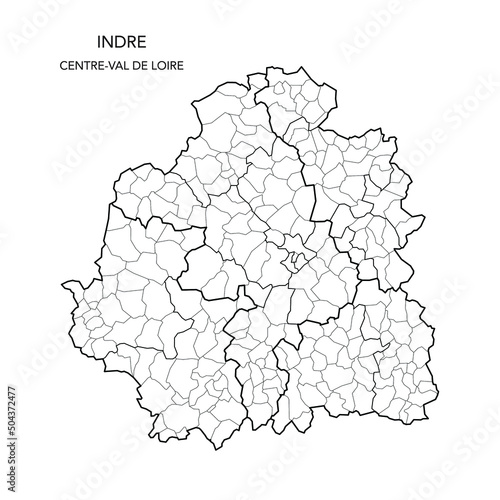
Vector Map of the Geopolitical Subdivisions of The Département De L’Indre Including Arrondissements, Cantons and Municipalities as of 2022 - Centre-Val de Loire - France
Contributor:
Dorky
ID : 504372477
Dateien
Drucke und Produkte
Titel
Filesize
Vektor
3000x3000
Buy on Adobe Stock
Titel
Preis
kaufen
Wall Art
Canvas Prints
30 USD oder Credits
Framed Prints
10 USD oder Credits
Prints and Posters
5 USD oder Credits
Metal Prints
10 USD oder Credits
Acrylic Prints
10 USD oder Credits
Phone Cases
iPhone Cases
30 USD oder Credits
Galaxy Cases
30 USD oder Credits
Home Decor
Pillows
18 USD oder Credits
Duvet Covers
100 USD oder Credits
Shower Curtain
50 USD oder Credits
Clothes
T-Shirts
20 USD oder Credits
Souvenirs
Greeting Cards
3 USD oder Credits
Bags
Tote Bags
20 USD oder Credits
Order print
Schlüsselwörter
2022
,
administration
,
administrative
,
atlas
,
background
,
berry
,
blank
,
border
,
boundary
,
cartography
,
center
,
city
,
country
,
detailed
,
division
,
france
,
french
,
geography
,
graphic
,
illustration
,
indre
,
infographic
,
internal
,
limit
,
map
,
municipality
,
municipality
,
outline
,
political
,
region
,
regional
,
subdivision
,
subdivision
,
territory
,
vector
,
village
,
village
,
department
Verwandte Artikel
 Deutsch